Agriculture Service Projects
Agriculture Service Projects provide end-to-end tailored support and solutions by our experts to address our customer’s unique agricultural challenges – allowing them to access the benefits without requiring product purchases.
Types Of Agriculture Service Projects
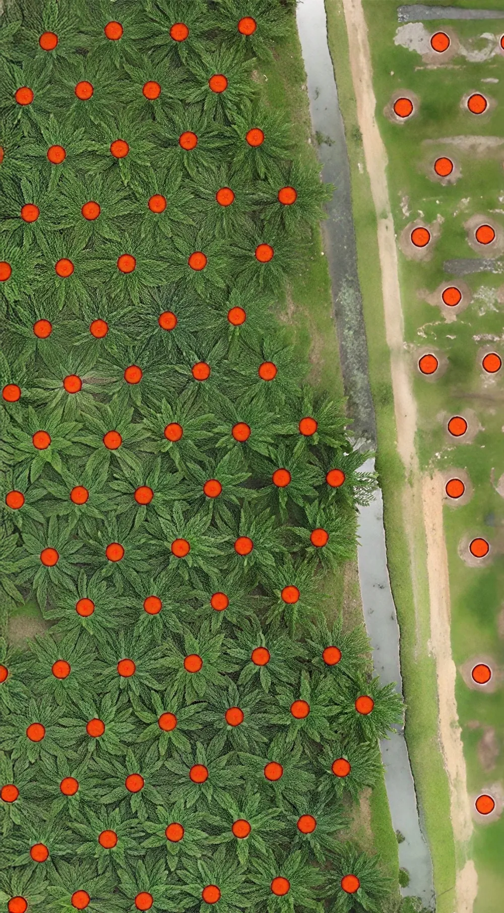
Tree Counting
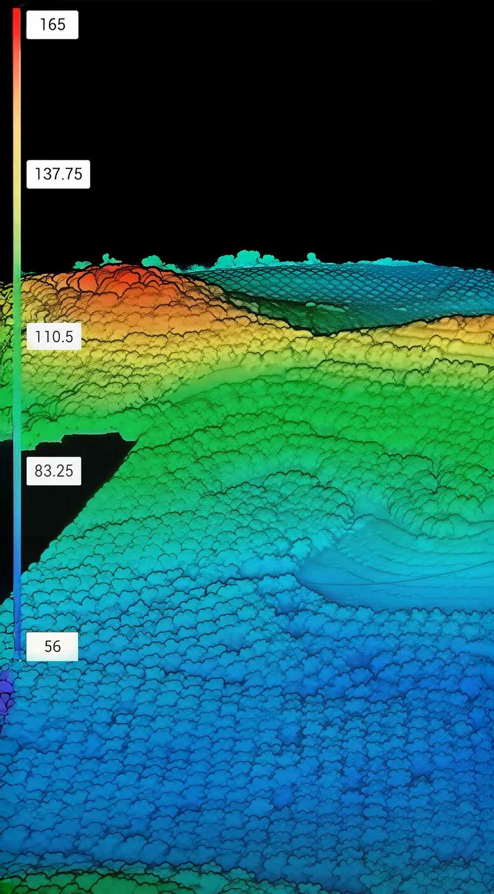
Elevation Mapping
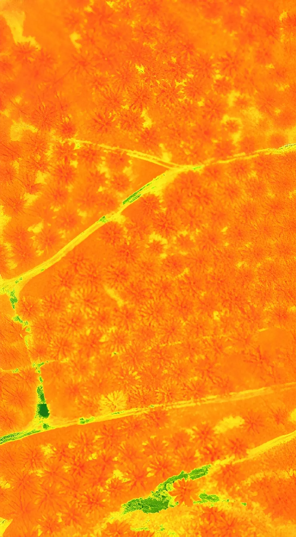
Multispectral Analysis
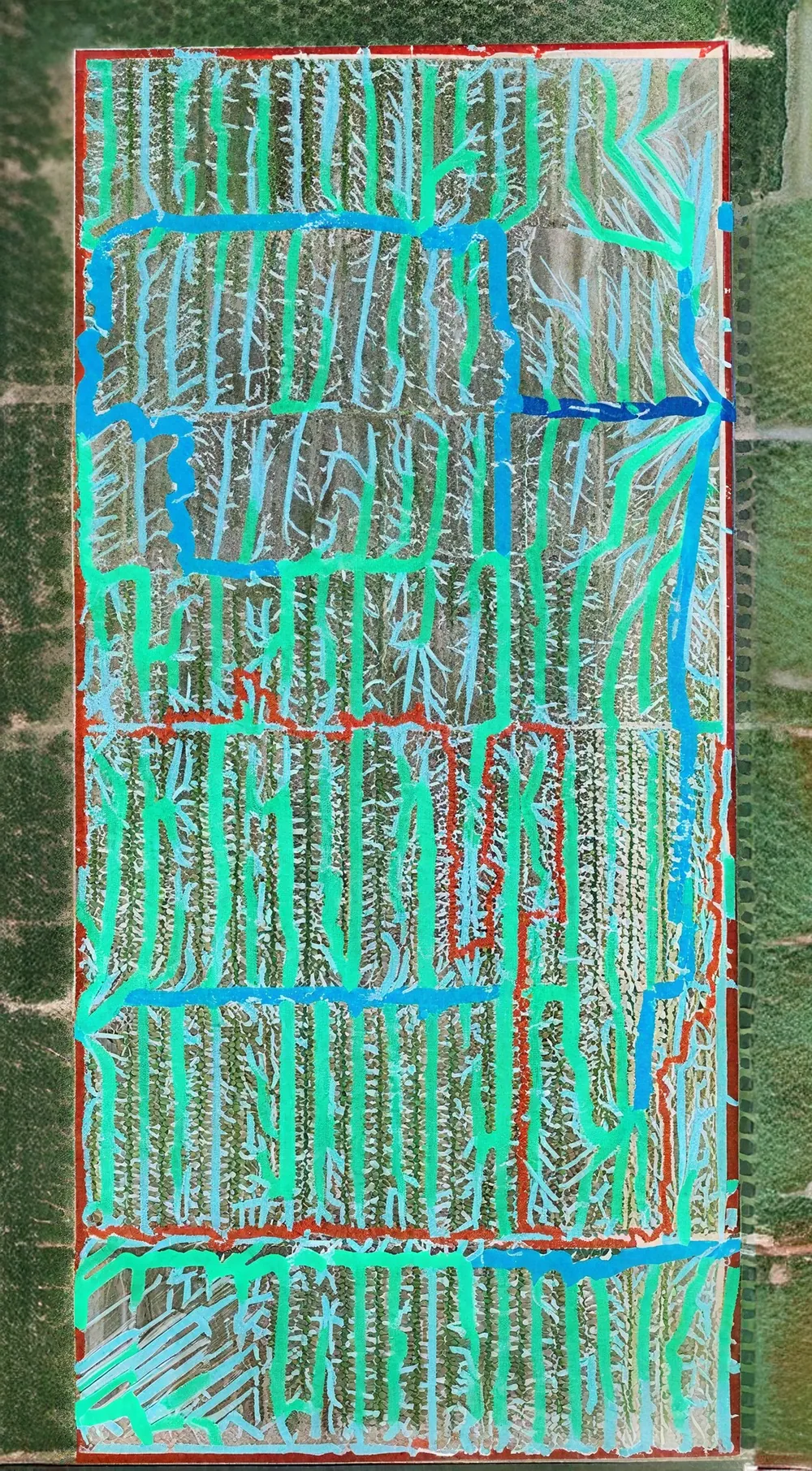
Water Flow Analysis
Why Work With Aonic For Your Next Agriculture Projects?
No Upfront Equipment Costs
Avoid the high capital expense of purchasing drones and machinery, so you can focus on your core business.
Access to the Latest Technology
Get the most advanced tools without worrying about upgrades or depreciation.
Expertly Operated by Certified Teams
Our trained specialists handle operations, ensuring accuracy and efficiency.
Data-Driven Results
We provide insights and reporting from each job — helping you make informed farming decisions.
Reliable Maintenance & Support
We handle all servicing and troubleshooting, so you don’t have to worry about downtime or repairs.
Applications
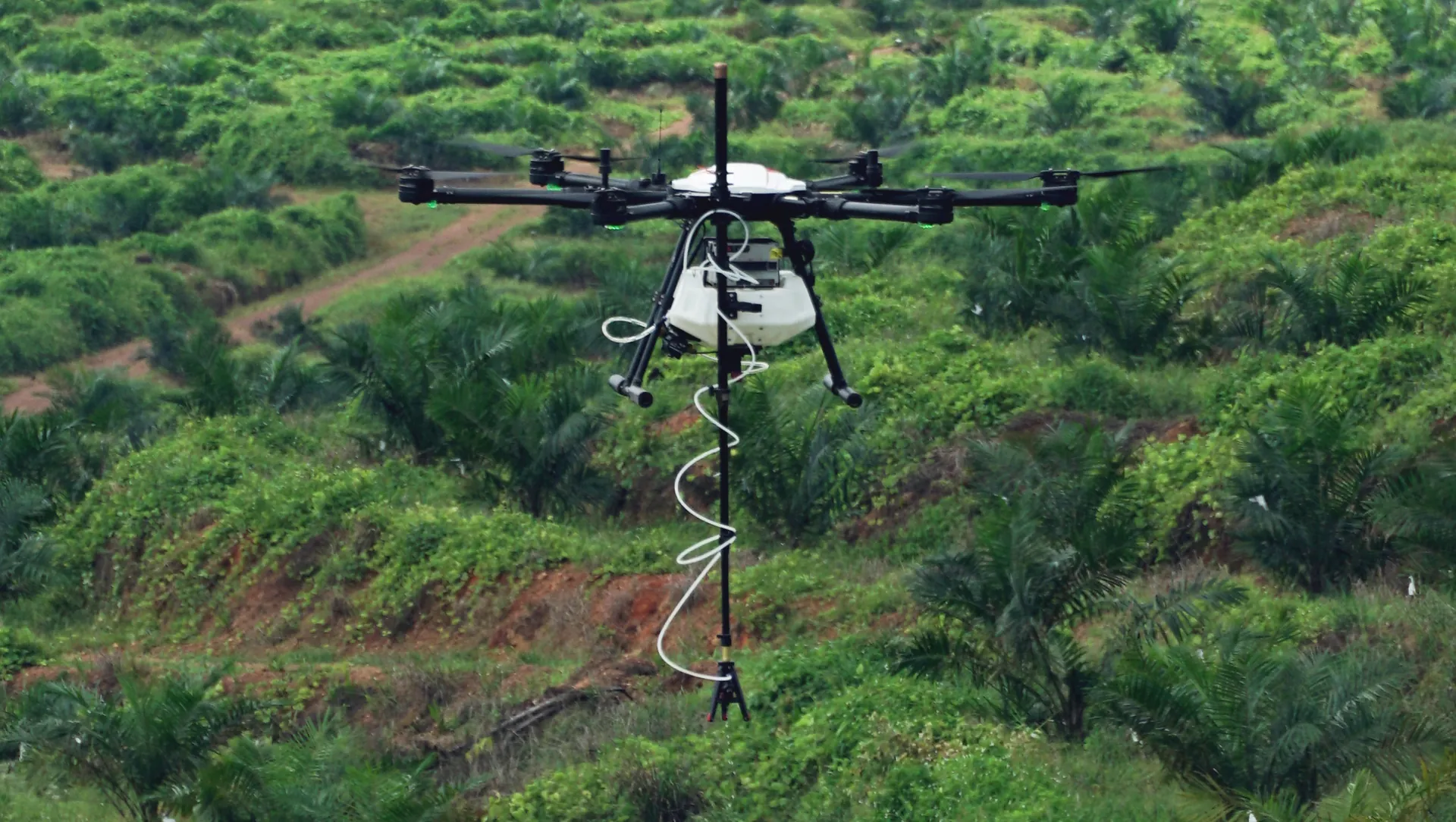
Rhinoceros Bettle (RB) on Immature Palm Oil
Rhinoceros Beetles (Oryctes Rhinoceros) damage young palms by feeding on tender fronds, slowing growth and cutting yields. With Aonic’s point-to-point spraying technology, pesticides are delivered directly to the crown – protecting palms, improving productivity, and ensuring safer, more efficient treatment.
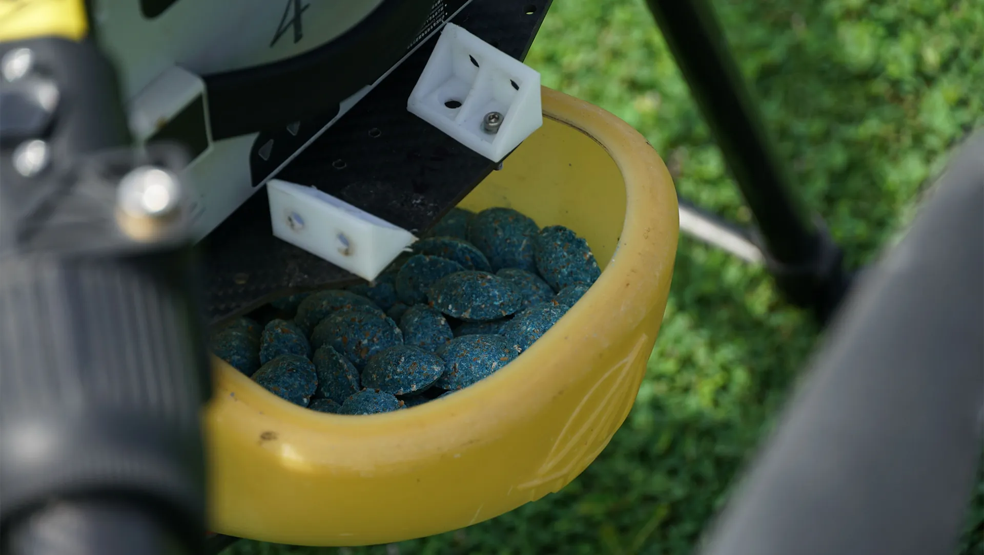
Rodent on Immature and Mature Palm Oil
Rodents (or Rats) attack both young and mature palms, damaging fronds, killing plants, and reducing harvest quality. Aonic’s drone-based rat bait dispensing delivers precise, scalable treatment while tracking effectiveness – cutting rodenticide use, improving yields, and maintaining ecological balance.
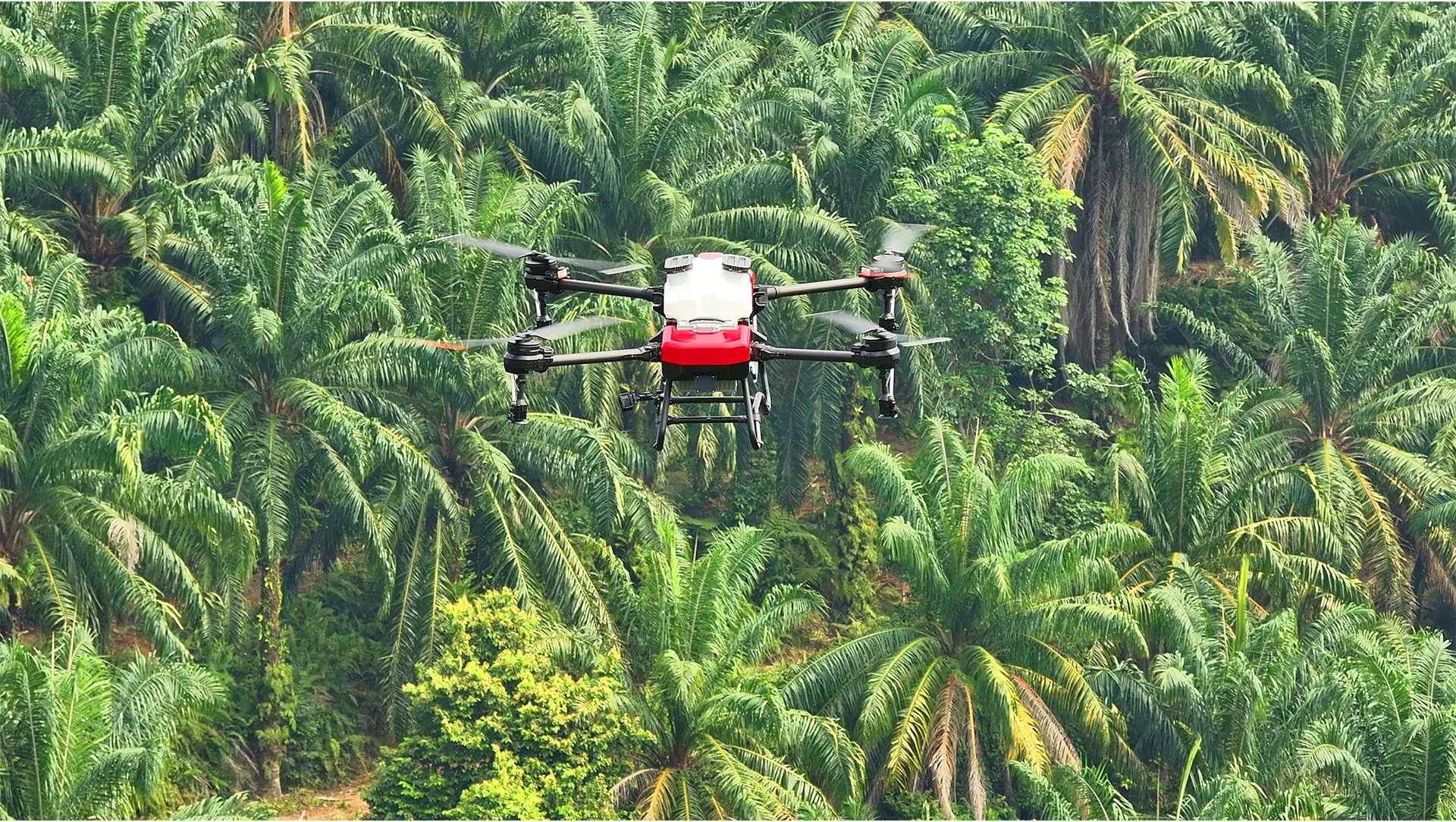
Bagworm in Palm Oil
Bagworms infest leaves rapidly, causing defoliation and heavy yield loss if treatment is delayed. Aonic’s blanket spraying delivers precise leaf coverage for faster control – containing outbreaks early, protecting yields, and ensuring plantation health.
Get In Touch
Have questions? Our drone experts are here to help