DISCOVER HOW DRONES ARE AIDING THE CONSTRUCTION WORKS TREMENDOUSLY BY OPTIMISING TIME AND MATERIAL MANAGEMENT.
Last week, we have discussed in-depth about the application of drones inside the agricultural field. There’s a whole lot more about drone application that can be realised through the technology advancement.
Today, we will be discussing one of the popular industrial application of drone; construction sector.
Construction sector is one of the biggest industries that is incorporating drone as one of the effective tools to aid the construction process.
Now, let’s see how exactly drone helped out through the various stages of a construction process.
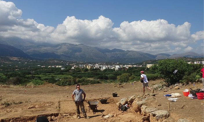
PRE-CONSTRUCTION
A pre-construction survey is a thorough process that documents the condition of the properties adjacent to or neighbouring your construction activity through visual observations, photographs, notes, and other diagnostic devices as warranted by the complexity of the project.
The pre-construction phase is very crucial for the engineers as there are a few things that needed to be surveyed. A construction survey typically consists of determining current site conditions for future above-ground and in-ground infrastructure.
Land surveyors stake elevations for footings, collect topographic data for mapping existing drainage courses, invert elevations and diameters of pipe and manholes perform a number of other services. Land surveying services are used to establish the accurate location of proposed structures, accesses, pipelines, buildings, and other improvements.

Land surveying method usually involves using human resources, heavy machinery & expensive surveying tools, that produce complex data. In actuality, you can get the job done in half the time & money, with greater accuracy by using drones.
Drones equipped with advanced payloads that can produce high-quality digitised map such as Digital Elevation Models (DEM), Digital Surface Models (DSM), and Digital Terrain Models (DTM).
Related: DEM, DSM & DTM Differences
These maps serve the purpose of the survey process, and in addition to site analysis, boundary & topographic surveys, maps, and plats, they also:
- Help mitigate the risk of potential future regulatory enforcement actions
- Minimize or eliminate costly delays in project schedules
- Maximize project startup efficiencies through comprehensive regulatory planning
- Provide data which helps define project scope and aids strategic pre-construction planning

DURING CONSTRUCTION
Minimising the risk and avoiding any accident is mainly the priority during the building phase, alongside materials management and quality inspection.
Drones are a lot safer to send in for inspections instead of manual inspection by the workers. Engineers and managers can identify the problems or any issues on the site via complete footage, live or recorded from the comfort of office desks.
Moreover, drones are suitable to be used for construction that is near any waterbody. Plus, through orthomosaic map produced by the camera payload mounted on drones, can help with detecting deviations and taking early corrective action, thus reducing thousands of dollars in change orders.
DJI ZENMUSE H20 SERIES – ALL THE SENSORS YOU NEED – IN ONE

Progress tracking and reporting to your client can be easier with the high reachability of drones. For example, you can track the level of the building completed simply just by deploying your drone and then comparing orthomosaics across various dates enable precise progress tracking and reporting.
A quite innovative way to use drone in construction is to examine the placement of post-tension cable. You can read more about this here: Using Drones to Reduce Risk in Concrete Construction
POST CONSTRUCTION
With drone, the BIM (Building Information Model) can be produced directly as it provides 360 degrees of views and insight of the building from bird-eye view.
Plus, aerial photography and videography can be a great marketing material of the property as aerial captured photos and videos are quite popular these days. Drones can reach places humans can’t, meaning you can capture a wide range of images of your building. These can be utilized in marketing collateral, on a company’s website, on social media platforms and beyond.
Drone-based method also can help in conducting after completion quality assurance process by identifying defects in the outer side of high-rise building.
ON GOING ASSET MAINTENANCE
Not only limited to the building construction, but also is beneficial in the long run; ie. the building maintenance and damage assessment. The data captured by a drone can be used to plan and improve long-term maintenance of the structure as well. After a project is completed, you can produce the as-built drawings and models created with the help of our drones. This detailed information makes it easier for the owner to renovate, manipulate and upgrade aspects of the facility in the future.
Drones equipped with thermal imaging can also fly over a building and detect if there are leaks in the building envelope. They can also identify areas of leak potential so owners can proactively maintain their facility before a small problem turns worse.
Drones can also help assess damage after a hurricane or any natural disaster. For example, if the roof is torn away by strong thunderstorm ; it is advisable to use a drone to safely identify the extent of the damage and plan for the proper repairs.
BOTTOM LINE
Drone are consciously changing how we are constructing buildings and structures. Information and data that once took days to be collected can now be captured with incredible accuracy in a matter of hours — this translates into huge time and cost savings for anyone.
Like any cutting-edge technology, the research and applications of drones change continually, and we should always be exploring how we can continue to leverage their benefits moving forward.
If you keen to explore the industrial drone technology, you can contact us for more information.