We have been talking a lot about how drones are used across industries, serving as the key to various automated processes such as mapping, spraying and so on. Precision mapping particularly has seen massive drone integration into its processes. That may be credited to the fact that the mapping accuracy is on par with the conventional land survey and reliable.
In this article, we will be looking at the mechanism behind surveying drone that has rendered it to be extremely useful in land surveying and construction industry.
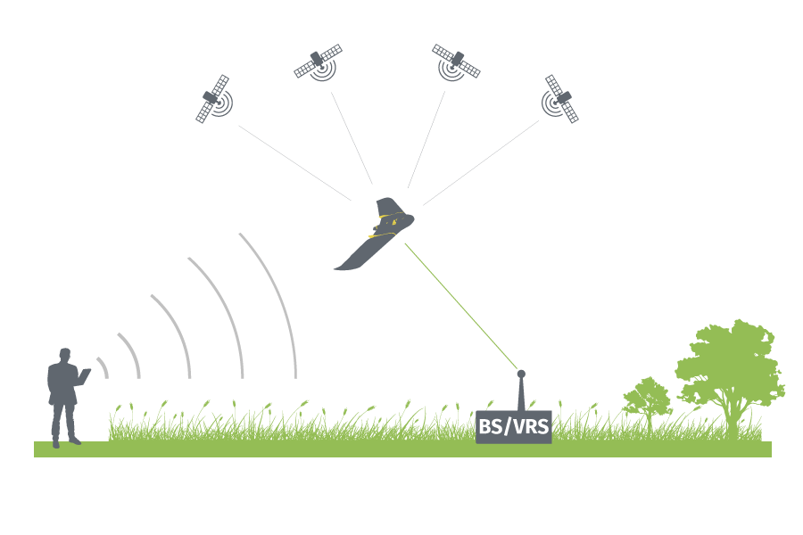
REAL-TIME KINEMATIC (RTK)
RTK stands for Real-Time Kinematics which is a GPS/GNSS technique used to enhance the precision of position data received from satellite-based positioning systems. RTK is centred on the usage of fixed base points which wirelessly sends out corrections to a moving receiver to increase the accuracy of GPS signals.
The satellite and base station corrections will enable more accurate and the GPS engine can fix the position of the antenna to within 1 – 2cm. Traditional GPS receivers, like the ones you can find in your smartphone, or on most robotic platforms could only determine their position with 2-4 meters accuracy.
Base point is actually a single GCP that constantly provides correction and calibration of the drone’s locational data. Successive GPS measurements at the base stations are paired with the GPS measurements made by the drone. This provides a mechanism for the reduction and elimination of the errors common between the two measurements. These corrections are applied real-time, requiring the drone and the base stations to communicate with each other constantly throughout the survey.

POST-PROCESSED KINEMATIC (PPK)
Post-Processed Kinematics or PPK is actually similar to RTK except for the fact all the corrections are done after the data collection. This means the need for base points as used in RTK processes is eliminated.
Drones that process data using RTK or PPK do not have different sets of hardware. Instead, a PPK drone merely uses a different processing workflow. Data collected by an RTK drone can be corrected using a PPK process, but it will involve a lot of customization.
You should be able to understand the basic mechanism of RTK and PPK before we move on to the comparative advantages that PPK haas over RTK which we will be discussing next week!